Welcome to the LnLP Forums and Resource Area

We have updated our forums to the latest version. If you had an account you should be able to log in and use it as before. If not please create an account and we look forward to having you as a member.

Situational Awareness Maps

Iconoclast

Member
Joined
Oct 26, 2014
Messages
130
Points
18
Location
germany
Amazing how much work you put in the task daz. I wouldn't want to be in your place.

Edit: Seeing the St. Vith Map again: shouldn't it be one US MechInfBn, one InfBn, and one TnkBn? You drew three MechInfBns. Is there any reason for that?
 
Last edited:

Daz

Member
Joined
Oct 22, 2014
Messages
861
Points
43
Location
England
Thanks for the feedback "A"
If you look back at the post of the starting image, there is no sign of any armour spotted yet.

The most southerly Battalion size concentrations most powerful spotted units are Mech infantry, as is the most easterly.
The concentration on the west side looks to be primarily Engineers that can easily be mistaken as Mech infantry due to their equipment (Halftracks) so I have marked it as Mech infantry, as that is what I would have assumed it was from experience, seeing this kind of concentration, with maybe a Coy of Engineers attached, had I been the opposing side here.
Maybe I should have marked it as a Bn of Engineers, but that would be a very unusual occurrence, especially as the bridge is neither primed or demolished yet.
 

Iconoclast

Member
Joined
Oct 26, 2014
Messages
130
Points
18
Location
germany
Got it. I missed that your are trying to preserve the FoW for both sides. That is certainly a difficult task, I bet you made the experience already that Battlefield Graphics can change drasticly depending on the Point of view, the FEBA is a prime example of that.
 

Dave 'Arjuna' O'Connor

Panther Games Designer
Joined
Jul 31, 2014
Messages
3,416
Points
113
Location
Canberra, Australia
Website
www.panthergames.com
Hey Daz, how about we refer to these as "Situational Awareness Maps" (SAM for short) and could you please do the maps from Greyhound Dash and Manhay Crossroads as the next priority after the tutorial. My reason for this is they are the three scenarios that come with the engine.
 

Daz

Member
Joined
Oct 22, 2014
Messages
861
Points
43
Location
England
Doesn't fit so well with my job title acronym, but your the boss ;)

Ill do Greyhound Dash next then.
 

SSG D

Member
Joined
Nov 9, 2014
Messages
29
Points
1
Age
75
Location
Mesquite, NV
Daz,
Your stitched together map of the entire area is great. I especially like the historical overlay information. By saving it as a photo on my iPad, I now have a great planning map. Ever since I started playing this game a few months ago, I have been searching through the Univ of Texas, 12th Army Group daily maps, and other sites trying to find a good planning map. You nailed it with this one. If anything I would love to see it cover more ground to the East.
Thanks
 

Daz

Member
Joined
Oct 22, 2014
Messages
861
Points
43
Location
England
I'm glad you said that mate, as I have always wanted something like that myself.
Once I have cleaned all the maps, and finished this project for Dave, I was going to start to add back the operational graphics to the large map as a whole, but on an almost daily basis, depending on how much historical information is know about the movements of the formations.
I guess I would have to just interpolate between known positions on known dates for some.
So we would end up with lots of maps of the entire battlefield area to cover each day of the offensive.
The problem with the existing old maps is they try to cover several days of movement on the same map, and it looks very cluttered, and confusing in my opinion.

Then I could add them all to a slideshow, and when played at fast speed it should be almost like a time lapse movie as the formations move across the map.
Kind of like the old Mutoscope flick movies you used to get on the pier.

It would be quite a huge task mind, and so would the file size of the finished slideshow!
 

Daz

Member
Joined
Oct 22, 2014
Messages
861
Points
43
Location
England
Starting on this scenario now as requested:

Greyhound Dash
Type: Allies Defensive Operation, then Counter-attack/Axis Offensive Armour Spearhead
Scale: Corps
Complexity: medium (Could do with some help to determine this, as its quite subjective. Anyone that feels it should be anything other than medium please speak up)
Duration: 06:21:01 (DD,HH,MM)
Preferred as: Axis (this is also a subjective opinion, feel free to speak up if you feel differently)


December 20th, 1944 0900 hrs.
Historical Scenario.
After breaking through the American lines between St. Vith and Bastogne, LVIII Pz Korps, made up of the famous 116th ‘Greyhound’ Panzer Division and the 560th Volksgrenadier Division, advanced west as fast as possible. On the morning of December 19th the Recon Battalion of the 116th reached the Ourthe River near Bertogne but found the bridges blown.
Having discovered that the town of Houffalize was unoccupied and the bridge still intact, General Krueger, commander of LVIII Pz Korps, ordered a counter-march for the 116th, sending it back through Houffalize, and northwest across the Ourthe river.
It is now the morning of December 20 and the 116th is ready to advance to the critical highway and crossing of the Ourthe at Hotton. the 560th VGD will cover the right flank.
The only US troops in the area are some engineers and the division trains of the 7th Armored. However, the Americans are recovering from the initial confusion and have begun moving reinforcements south to shore up the battered Northern flank of the bulge. Three columns of 3rd Armored Division’s reserve combat command are moving south to block the approaches to the Ourthe River while the other two Combat Commands (CCA and CCB) were committed elsewhere.
The Historical reinforcement schedules for both sides reflect the historical arrival times and locations of units in the battle. The Favour Allies and Favour Axis settings provide alternatives favouring one side or the other.
Start: 20 Dec 1944 09:00
End: 27 Dec 1944 06:00

Once again, its going to take me a few evenings to clean the map.
Greyhound-Dash-unclean.jpg
 

Rob

Member
Joined
Oct 22, 2014
Messages
155
Points
18
Location
Vancouver BC, Canada
Hi,

Nice style Daz!
Informative without being too wordy and the maps are a really nice touch. As to the measuring the scenario's "complexity" I suspect for many players that's really another way to say "size". Maybe not....
In any case, if someone could provide you with the number of victory locations per side plus the total number of units per side the resulting sub-total per side (where each individual location and each individual unit are worth 1 point) and a grand total of both sides, would be indicative of size and complexity.

AXIS VP locations: 7 Total Axis Units: 213 Total Axis: 220
ALLIED VP locations: 8 Total Allied units: 150 Total Allied: 158
Grand Total: 378 = Medium complexity

If memory serves, something like this was done by a contributor to the original HTTR years ago.
Just a thought.

Rob.
 

john connor

Member
Joined
Oct 22, 2014
Messages
2,488
Points
63
Age
60
Location
Brussels
Great work, Daz. For what it's worth - though the cleaned up maps are super - I myself would prefer to just see the in game maps, as in your first example. But maybe that's not possible? If you see the info you're trying to convey on the actual maps you will then use playing the scenarios (and let's face it, they're excellent maps) then you don't have to go through any mental conversion process. Just my tuppence.
Peter
 

Daz

Member
Joined
Oct 22, 2014
Messages
861
Points
43
Location
England
Thanks for the help with the scenario complexity guys.

The problem is Pete, that the size of the Awareness images that are going to go into the interface, are very small 640 X 480 px..
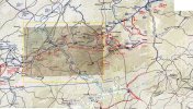
When the game map (here is an example of the Greyhound Dash map is scaled down to that size in my opinion it just becomes a brown messy blob.
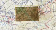
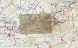
Here is an image at 100% resolution for the background map (the one I am cleaning) inside the 640 X 480 px frame (yellow rectangle), with the Greyhound Dash map in the centre.

It would be preferable to keep the maps I am cleaning up at 100% resolution as you will still be able to read the place names.
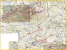
The problem with that is, in this scenario description for example a lot of the tactical situation mentioned actually happens quite a way to the east.
So to try and include that kind of awareness into the map the whole thing may have to be scaled down inside that frame, as in my second example image.
This will cause the place names to become illegible, and the game map to become an even worse brown blob.

In my opinion the most pleasing to the eye is to have the game map opacity right down so that the detail of the base map can be seen through it, but the outline of where the game map should be is still clearly visible.
Grreyhound-Dash-ex1.jpg Grreyhound-Dash-ex2.jpg
 
Last edited:

Daz

Member
Joined
Oct 22, 2014
Messages
861
Points
43
Location
England
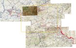
If I am going to show the scenario briefing on this map I need to go right back to the German border, which means I will have to scale the map down to this size, (see image below) which I think might be to much?
I think maybe its best just to stick with the 100% scale on the background image, and just fit in as much of the briefing that falls within this frame, at this scale, as it allows.
Grreyhound-Dash-ex4.jpg
 
Last edited:

john connor

Member
Joined
Oct 22, 2014
Messages
2,488
Points
63
Age
60
Location
Brussels
It's extremely impressive that you've learned all this, Daz. My hat is off. I understand now why they must be other than the game maps. I'm amazed at how quickly you're producing this material too. Maybe you'll get the two sample scenarios done in time for the release.
 

Daz

Member
Joined
Oct 22, 2014
Messages
861
Points
43
Location
England
Ill give it my best shot, but its very unlikely I will get them done before Christmas I'm afraid mate.
I am in the process of dismantling a 150ft Macrocarpa Tree at work, that is in a very dangerous state, and needs to come down before the next big storm, or its likely to come down on someone's head.
It is going to be leaving me very sore, and tired in the evenings this week.

I don't actually need much sleep, but find it hard to sit still, and concentrate when I am physically tired. Also I tend to use red wine, just for medicinal purposes you understand, to numb the pain of sore joints, and that also make it hard to focus :rolleyes:

Unless we get some bad weather where its to wet or windy to climb, then I get to stay home. ;)
 
Last edited:

Daz

Member
Joined
Oct 22, 2014
Messages
861
Points
43
Location
England
Yes for 24 years now. Started after I left the forces in 1990.
 

john connor

Member
Joined
Oct 22, 2014
Messages
2,488
Points
63
Age
60
Location
Brussels
Fantastic job, I always think, whenever they come round to take down our trees and the kids stand there gobsmacked as they glide up the trunks and swing around and hang off with such careless abandon. And you get to work 'with nature'. And outside. Cool.
 
Top