Welcome to the LnLP Forums and Resource Area

We have updated our forums to the latest version. If you had an account you should be able to log in and use it as before. If not please create an account and we look forward to having you as a member.

Sword to Caen

Bie

Member
Joined
Feb 22, 2017
Messages
350
Points
28
Age
42
Location
Belgium
Thanks for the input Hubeeo and Jim.

Indeed, I don't want the scenario to be to much of a railroaded affair. For the moment I'm going to let the bridges be destroyed from the start of the scenario. I am however still putting in some defend objectives (with occupation points) at the bridges that end at the time they would have normally been destroyed. This way I'm still putting in some kind of incentive to go there and clear out the area of any troops, while still being rewarded for doing so.
 
Joined
Feb 24, 2016
Messages
11
Points
3
Age
60
Location
Canada
It sounds great and your map looks amazing! I do agree with the idea that that Command Ops2 is best suited to manoeuvre warefare as opposed to attrition battles, but I can’t wait to see what you come up with. Seems like the flood gates on senarios may be starting to break open!!
 

john connor

Member
Joined
Oct 22, 2014
Messages
2,488
Points
63
Age
60
Location
Brussels
Fantastic map, Bie. Hats off to you. That's a lot of work. Ditto the estabs.

There are some map issues, though. In the very small scenario the problems with the actual terrain grid not matching the images is quite bad in some areas - I've looked at the same areas I posted to you about a few weeks ago and seen issues, but I guess this is because the grid size has gone up now and there might not be much you can do about it.

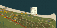
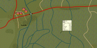
For the main map, however - for Sword to Caen - I'm assuming you used a 100m grid? In which case I don't quite know why errors have occurred, but they have. If you click around the map you will come across multiple instances of mis-match. 2 examples posted in the pics below.

1.gif


2.gif

Many of the 'forts' you've created don't show up as forts at all.
 

Bie

Member
Joined
Feb 22, 2017
Messages
350
Points
28
Age
42
Location
Belgium
Fantastic map, Bie. Hats off to you. That's a lot of work. Ditto the estabs.

There are some map issues, though. In the very small scenario the problems with the actual terrain grid not matching the images is quite bad in some areas - I've looked at the same areas I posted to you about a few weeks ago and seen issues, but I guess this is because the grid size has gone up now and there might not be much you can do about it.

For the main map, however - for Sword to Caen - I'm assuming you used a 100m grid? In which case I don't quite know why errors have occurred, but they have. If you click around the map you will come across multiple instances of mis-match. 2 examples posted in the pics below.

View attachment 6217


View attachment 6218

Many of the 'forts' you've created don't show up as forts at all.

Well spotted John. At first I was stumped as why the polder wouldn't show. But it turns out I didn't calculate the grid when I last worked on the map. So that was easily fixed.

On the other side the forts, oh boy the forts... They are turning out to be a thorn in my side ;). It is quite fiddly to get right and it needs to be big enough for them to show as an actual fort in game terms. Yet in reality the forts were not that big as some were only one or two small casemate 644's. I though of actually forgoing the smaller forts and integrating casemate 644's in the estabs. It would be a static vehicle then, but I guess it would also serve the same goal. Also I can detail which guns were embedded in the forts and which ones weren't, as not all of the static guns turn out to be encased. So for the moment I haven't done that, but I might in the future.

As for the grid size, indeed I kept the standard 100m grid. The amount of units coming onto the map would quickly make it unplayable in terms of game speed. A shame that the detail is gone around the bridges, but that is the way it has got to be.

I'm updating the map and making the forts where static German units are garrisoned bigger, so that at least is correct.
 

john connor

Member
Joined
Oct 22, 2014
Messages
2,488
Points
63
Age
60
Location
Brussels
Static units plus forts might be a good compromise. Might be the only way to stop the AI moving units out of the positions you choose at scenario start, where those positions are key. And I always think you can't worry about the size of individual items too much since it's a map, and only a representation of reality - and forts are objects that exert a larger 'footprint' than their scale size would suggest.
 

john connor

Member
Joined
Oct 22, 2014
Messages
2,488
Points
63
Age
60
Location
Brussels
SPOILER ALERT ********


Is Sword to Caen historical? There's nothing defending Benouville bridge.
 

Bie

Member
Joined
Feb 22, 2017
Messages
350
Points
28
Age
42
Location
Belgium
Is Sword to Caen historical? There's nothing defending Benouville bridge.
It should be quite historical. I opted to leave the coup-de-main out of the scenario due to its scope. The coup-de-main forces landed at about 00:16h. Within minutes they had taken their objectives and neutralised the defenders (which turned out to be about 50 men defending both bridges). That's why I let the scenario start at 00:30h, at that time actual seizing of the bridges would have taken place. I thought it might be better to start off like that.
 
Last edited:

Bie

Member
Joined
Feb 22, 2017
Messages
350
Points
28
Age
42
Location
Belgium
I've noticed that both sides are to defensive. I'll update their objectives and put it in the next update.
 

Kurt

Member
Joined
Jan 4, 2015
Messages
896
Points
28
Age
58
Location
England
Getting the balance right with objective values and timings is tricky , lots of testing and tweaking helps .
 

Bie

Member
Joined
Feb 22, 2017
Messages
350
Points
28
Age
42
Location
Belgium
The development of the scenario has come to a point where I'm getting quite happy with the result.

The AI is starting to do its thing well and the OOB should be stable. I might still tinker with the (favour) reinforcement schedule though.

Appart from that there is still quite some flavour text to be added (including the briefings) and the unit and commamder skills should still be tweaked a bit.
 

Grognerd

Member
Joined
Nov 28, 2017
Messages
215
Points
28
Age
72
Location
Melbourne, USA
I have downloaded and am playing it now. Looks like a lot of hard work! I know this battle quite well, I may give feedback (constructively of course!). You are to be commended for a real nice job from what I see so far... Map is superb!
 

Bie

Member
Joined
Feb 22, 2017
Messages
350
Points
28
Age
42
Location
Belgium
I have downloaded and am playing it now. Looks like a lot of hard work! I know this battle quite well, I may give feedback (constructively of course!). You are to be commended for a real nice job from what I see so far... Map is superb!

Thanks Grognerd, comment on anything you like. I've released the 1.0 version of the scenario pack, but if I find any bugs or problems I'll probably still amend that. I don't know the battle to well though, except for my research done for all of the scenarios. So if there are some inconsistencies just let me know.
 

Grognerd

Member
Joined
Nov 28, 2017
Messages
215
Points
28
Age
72
Location
Melbourne, USA
Yeah, I've been there this summer. So it's all still quite fresh in my memory .
Caen is an interesting city and Normandy is a definitely beautiful region.

Anyway another update: i've added about one kilometer to the east of the map. Turns out not all of the objectives for the 6th Airborne were on the map.

Which brings me to a problem: the 6th needed to blow five bridges to the East of the Orne. As far as I know we only have the deny crossing option in Co2. Which would mean that I'd have to keep at least some units there to actually blow the bridges once the enemy arrives. In reality they just blew them up and retreated back to the rest of the division. I'm not sure how to solve this.

Yeah, after playing for a bit a I went back and reviewed the manual about Deny Crossings and did a search on the Forums - no way to just blow bridges! So now I'm thinking the initial plans I laid out are invalid, more or less, I'm not sure I want 2 battalions just sitting around with a deny crossing mission in the somewhat isolated areas they are in. We will see.
 

Grognerd

Member
Joined
Nov 28, 2017
Messages
215
Points
28
Age
72
Location
Melbourne, USA
Well after playing a bit, this scenario is quite well made. Only thing I noticed is some of the German Estab names are so long they block out the quantity when viewing them in game. Also the some of the shore bombardment batteries have run out of ammo and are not being replenished but that may be intentional and realistic. Have not finished the scenario yet! The 6th sure is getting the brunt of the 21st Panzer for counter attacks, hold until relieved! But it better be soon!

Reviewing the map now to see if it has "accidental" urban sprawl from modern source maps. Next will be the OB.

I stumbled upon a real nice site for 1944 maps of the region - https://ignrando.fr/boutique/patrimoine/espace-photo.html - This is in French but it's pretty easy to figure out. Aerial views from 1944 recon missions and tactical maps with elevations. I don't know what your source map was but these are tremendous for this kind of work. Edit: upon further review I did find the hand-drawn maps are dated 1866, a bit too old for WWII. The aerial views are excellent though. And another map source dated 1943 with topography can be found - http://library.mcmaster.ca/maps/ww2/ww2_Fran_Belg_Holl_ndx100k.htm
 
Last edited:

Bie

Member
Joined
Feb 22, 2017
Messages
350
Points
28
Age
42
Location
Belgium
Great find there Grognerd, those are some really nice pics. I could have used them to give Caen a bit more detail.

As for the naval guns running out of ammo, that is intentional. I've read that each of the ships in the flotilla had a specific target which it needed to bomb before the soldiers went ashore. Basically all of the "Widerstandsnest" (Wn's) got bombed to a pulp. Afterwards the ships were on call to provide support for the assaults themselves and the push inland.

I've read also that HMS Warspite had to go back to harbour for rearmament and quick repairs at the end of day two. It had been shelling so furiously that its complete ammo stores had been spent and that the barrels of the main guns needed repairs due to continual firing. I don't have any specific sources for the rest of the ships though, but I can imagine that ammo shortages would be plaguing them as well.
 

Grognerd

Member
Joined
Nov 28, 2017
Messages
215
Points
28
Age
72
Location
Melbourne, USA
Well your map is great I did find a 1943 map at the site above (mcmaster) - your map matches a 1943 map pretty darn well! Kudo's again.
I guess I should finish playing it!
 

Grognerd

Member
Joined
Nov 28, 2017
Messages
215
Points
28
Age
72
Location
Melbourne, USA
Well Bie, I was so inspired by your scenario and the 1943 map source I found I said, hmm, I wonder if a Omaha to Sword scenario would be too big?

I decomposed your map to see how you created it and I now finally understand the map making tool - Thanks for that!

I took 3 of the source maps and stitched them together to make one source underlay MapScan 0. It's about 2450 square kilometers (a little larger than recommended) But heck 1/5 of it is water, so we will see. If it does not work out I'll split it into Omaha - Gold, Juno Sword.
Seems like there are already enough modules out on the western front to support establishments.

I'll stop hogging your thread and make a new one of I get that far! Ha... I don't know why but D-Day has always been my favorite game topic.
I was messing around with Guadalcanal, but it's on hold. Mostly due to the excellent 1943 topographic map I found put out by the US war dept. of the Normandy areas - By the way, that same source website has most of Europe and parts of Russia in their archives.
 
Joined
Oct 20, 2014
Messages
1,183
Points
63
Age
76
Location
Livonia, MI (Detroit-area suburb)
. . .
I was messing around with Guadalcanal, but it's on hold. . . .

I knew you were working Guadalcanal. I've got a minor reading library assembled over the past 20 or so years on the battle, and have assembled some source data beyond what I shared with you in the past to support development of a scenario on the battle.

After I finish the Saipan effort, particularly to get the balance between the Japanese organizational behavior vice the Allied behavior, I was considering embarking on another Pacific Front effort -- Guadalcanal being a prime target.

If it's not stepping on your toes, I'd like to work on Guadalcanal next.
 

Bie

Member
Joined
Feb 22, 2017
Messages
350
Points
28
Age
42
Location
Belgium
Normandy is a mapmakers wet dream, it is just about the most photographed and mapped area of WW2. And most of it is readily available online. I used this as base for my Mapscan. It is a nice and detailed GSGS map from '43. For Caen itself I just put this one in my browser and peeped from time to time to add more detail.

My choice for Sword was twofold: 1. I love anything about the British Airborne and Pegasus Bridge and 2. Sword was the Eastern most flank and cut off from the rest due to the counter attack of the 21st Panzer. This made the scenario more manageable in terms of OOB, as I didn't have to include the forces from Juno.

I'm guessing it is possible to make a map including most of the beaches, but I'm not sure if that would translate well to an all encompassing scenario. I think the sheer number of units on the map would make it unplayable in terms of speed (the more units, the slower the game). Cutting the scenarios beach per beach would be more advisable.

Hope you get into your groove while trying out the mapmaker. It is not that difficult, but it sure takes a lot of time. Give me a shout if you need some help.
 
Top