Welcome to the LnLP Forums and Resource Area

We have updated our forums to the latest version. If you had an account you should be able to log in and use it as before. If not please create an account and we look forward to having you as a member.

Situational Awareness Maps

rjantzi

Member
Joined
Dec 30, 2014
Messages
81
Points
8
Location
Vancouver, BC
Beautiful mapping. I can't wait until these are incorporated into the game. Thanks for all of your work to add to the overall experience.
 

The Plodder

Member
Joined
Oct 18, 2014
Messages
290
Points
28
Location
New Zealand
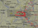
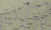
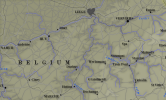
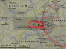
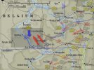
I've just finished the redo of the map that I started these with, Race to Bastogne, so I thought I'd show you the comparisons of old vs new and how much higher quality I think the redone maps are. The old maps were a fudge of 3 different maps used as templates and a low res contour map. I had to bend things around to get them to fit. I also had to add new map items every time I shifted the map area. The unit symbols were also copy and paste jobs with varying quality. The new maps are from one hires template with additional parts from Google Maps and I'm using a master that every map is based off. I then add the scenario specific towns and items to each map.The unit symbols are now vectors where I can change things a lot easier and less messier. Here's the comparisons:

Old:
Race For Bastogne12.jpg
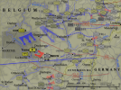
and new:
Race For Bastogne.jpg
 

rjantzi

Member
Joined
Dec 30, 2014
Messages
81
Points
8
Location
Vancouver, BC
Wonderful work, Plodder, One quick question. Have you reversed the way elevations are shown? On the "old" map legend the darker colour indicates a higher elevation. On the "new" map it seems to be the reverse. If I'm not mistaken, I believe the in-game maps use the darker colours to indicate higher elevation. It may be just the fact that I'm red-green colour blind but I have an easier time seeing the elevation changes on your "old" map.
 

The Plodder

Member
Joined
Oct 18, 2014
Messages
290
Points
28
Location
New Zealand
Wonderful work, Plodder, One quick question. Have you reversed the way elevations are shown? On the "old" map legend the darker colour indicates a higher elevation. On the "new" map it seems to be the reverse.
Yes, I have. Look at the example below. This map is light to dark.It looked ok but the darker higher elevations were washing out the lower ones and making it hard to read them. This was also due to having subtle shading underneath rivers and each elevation.
bulge example_old.png
When I reversed the colours, everything seemed to flow a lot better; I could see the lower elevations under the rivers and the contours seemed to pop out more:
bulge example_new.png

If I'm not mistaken, I believe the in-game maps use the darker colours to indicate higher elevation.
Yes they do but the winter maps are reversed and I've personally always found them easier to read.

It may be just the fact that I'm red-green colour blind but I have an easier time seeing the elevation changes on your "old" map.
It may not help that the examples I've been showing are in jpg format, so might not be as clear they should be due to compression. The above are are in png format. How do they look now?
 
Joined
Oct 24, 2014
Messages
83
Points
8
Age
69
Location
Groningen, NL
Website
springelkamp.nl
For the Ardennes the accentuated valleys work well, because it is not a landscape with hills, but high plains with worn out river valleys.

For a real hill landscape the reverse scheme would probably work better.

In the Northern Netherlands a hill of 6 metres height represents the difference between solid ground and swamp. So there a completely different colour scheme would make sense again.
 

rjantzi

Member
Joined
Dec 30, 2014
Messages
81
Points
8
Location
Vancouver, BC
Thanks for the explanation. I do find the png formats a little easier to decipher. I believe the issue I'm having is based upon my colour blindness. To my eye, the colours used in the first example above have greater contrast and that makes it easier for me to differentiate between them. The newer maps have more subtle changes in colour and therefore the elevation changes aren't as immediately obvious to me.
 

The Plodder

Member
Joined
Oct 18, 2014
Messages
290
Points
28
Location
New Zealand
Thanks for the explanation. I do find the png formats a little easier to decipher. I believe the issue I'm having is based upon my colour blindness. To my eye, the colours used in the first example above have greater contrast and that makes it easier for me to differentiate between them. The newer maps have more subtle changes in colour and therefore the elevation changes aren't as immediately obvious to me.

I'll tell you what, when I've completed the maps and they've been released, I'll make a reversed contours mod for those that prefer the other way. :) It's about 8 mouse clicks a map to do, so it won't take too long to do.

Another update, and another change. :D I wasn't happy with the fonts, as they weren't sharp enough for my liking, so I changed them. Much happier now.

Race For Bastogne SAM.png
 
Last edited:

The Plodder

Member
Joined
Oct 18, 2014
Messages
290
Points
28
Location
New Zealand
I've worked my way up to 21 Dec 1944 so that means I've managed to finish one of the scenarios from the core game, Greyhound Dash. Here's the original:
Greyhound Dash.jpg
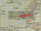
and here's the revised version:
Greyhound Dash.png

I've changed where some units positions and front line traces were after some more careful research. I've also moved the map east a bit as there was a too much dead space for my liking. Every map takes it's information from the scenario briefing, if a landmark or village is mentioned, I'll make sure it's on the map. :) I'm also reducing the size of town names if they make the map too crowded.
Next up is 22nd Dec, which has 4 scenarios set during that day so that will be good chunk of them done.
 
Last edited:

Daz

Member
Joined
Oct 22, 2014
Messages
861
Points
43
Location
England
It looks great Rich.
Amazing you have managed to fit so much info, into such a small space, so neatly.
Well done mate :cigar:
 

GoodGuy

Member
Joined
May 20, 2015
Messages
444
Points
28
Location
Cologne
I'll tell you what, when I've completed the maps and they've been released, I'll make a reversed contours mod for those that prefer the other way. :) It's about 8 mouse clicks a map to do, so it won't take too long to do.

Another update, and another change. :D I wasn't happy with the fonts, as they weren't sharp enough for my liking, so I changed them. Much happier now.

View attachment 1653

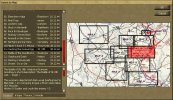
Excellent work. That's pretty much what I suggested in 2009, after Dave had posted the first screenshot of BFTB's main menu, though. At first, he didn't understand what I meant, so I posted a rough layout as jpg. But he either didn't like it at the time, or he thought that there was no time to get it into the game. This is the jpg I posted in the Matrix forum, back then:

selection.jpg

Whatsoever, your work is ironed out and even more detailed than what I suggested as new feature, back then. Good job.
 

The Plodder

Member
Joined
Oct 18, 2014
Messages
290
Points
28
Location
New Zealand
While doing these maps, I've been referring to the US Army Green Book The Ardennes:The Battle of Bulge by Hugh Cole. It's available online from a couple of sources, you can download a pdf from the US Army and there's also a couple of html versions as well. I've been using hyperwar for the maps as their copies are a lot clearer than the Army's and using the pdf to search through the text.. Anyway, as I've been skimming through looking for unit locations on specific days at specific times, I find myself actually reading more and more of it. It really is a brilliant book, even if it was written before the Ultra secret came out, the detail is incredible and the maps are awesome. I've been so impressed by it that I've just bought myself a used copy of the 2001 edition for my library for NZ$40. $38 of that is shipping! :D I figure that even if the maps of this edition aren't the greatest, I can always print out the maps from hyperwar on A3 paper at work and put them in the back.
 

Daz

Member
Joined
Oct 22, 2014
Messages
861
Points
43
Location
England
Yeah I totally agree Richard.
Its a superb read, and his maps are great.
A magnificent reference for the Battle of the Bulge, that I don't think has been done as thoroughly for any other campaign during the Second World War?
I could be wrong as I'm not that well read on the period.
 

GoodGuy

Member
Joined
May 20, 2015
Messages
444
Points
28
Location
Cologne
While doing these maps, I've been referring to the US Army Green Book The Ardennes:The Battle of Bulge by Hugh Cole. ... Anyway, as I've been skimming through looking for unit locations on specific days at specific times, I find myself actually reading more and more of it. It really is a brilliant book, even if it was written before the Ultra secret came out, the detail is incredible and the maps are awesome.

Yes, I like it very much, too.
It has a few hm.. let me call it downsides, though. The following quote is a piece of a post I wrote in the Matrix BFTB forum in 2012, when Wodin and others suggested to put more detailed statistics in the game, I think:

GoodGuy said:
I think it's more realistic if there are no uber-accurate logs and statistics, as such evaluations were (and partially still are) quite difficult, and because the body count on the ground, after enemy forces had been driven off, would not reveal the whole truth. That was quite obvious during and after the Battle of the Bulge, where the US High Command assessed a way higher efficiency of Allied tactical bombings than was actually achieved. Allied fighter bombers and tactical bombers were credited with killing a certain amount of German Armor, where the actual body count and inspection of the German tanks on the ground revealed that quite some of them had been abondoned and subsequently destroyed by their crews due to lack of fuel, or damaged/destroyed by Allied ground units. Hugh M. Cole addressed this problem in the official Army history partially, but still worked with wrong figures here and there, as quite some German sources were either lost/incomplete or not found, at the time.

A good example of the use of "wrong figures" (as either German documents were not at hand or were not considered) is PFC Rosenthal's (3rd platoon of the 820th TD Bn that was equipped with M5 AT guns) famous encounter, where the AAR states that Rosenthal sighted 5 German tanks, "a hostile pillbox" and "two German-occupied buildings", and that his gun cut right through the Pz.IV tanks at distances of over 500 yards, "APCR and HE shells causing complete destruction of the tanks, the ammunition truck, the pillbox, and also inflicting 90 casualties on the enemy personnel".

In his book "The Ardennes, 1944-1945", swedish author Christer Bergström contrasts the assessments and collections, based on Allied AAction-Reports, US witness reports (also written ones from captured German officers, who commanded units on either divisional or Korps level) and post battle-analyzis, from Cole with entries found in the war diary of the German II. Abteilung of Panzer-Regiment 16 (Cole considered war diaries, though) AND with additional personal accounts that were not available to Cole or not considered by him, at the time, for example, not just to give the German perspective, but also to assess the (logistical) effect/outcome of particular encounters and the accuracy of Cole's and/or general post-war assessments. The Bn's war diary describes the encounter with the 3rd platoon's gun slightly different, but seems to back up Cole's assessment, regarding the number of knocked out tanks, at least:

"From an anti-tank position somewhere in the vicinity of Diedrichsborn - Bock, our tanks were exposed to heavy fire. Within a few minutes six tanks are knocked out. The road is blocked. Covered by fire from the pillboxes, the other tanks pull back. Our tanks manage to neutralize 3 anti-tank guns, but our attack had to be cancelled."

So, there were more tanks, plus a 6th tank got knocked out, and troop casualties and the loss of an ammo truck were not mentioned. Cole and McDonald assessed that German tank losses during the first day in that sector amounted to "at least fifteen" or "at least thirteen", respectively. According to Bergström, the divisional commander (of the 116. Panzer-Division) von Waldenburg had a different description of the same event:

"In general the American resistance was weak except in the woods west of Berg where the enemy fought very bravely and fiercely. The commitment of German tanks west of Lützkampen soon forced the enemy to withdraw from his position. Weak enemy harrassing fire was reported from Kesfeld, Uttfeld and Leidenborn and from the road Uttfeld - Leidenborn - Lützkampen .....[ ].
The two assault companies sustained heavy losses. The assault company of the 60. Regt was nearly destroyed, the assault company of the 156. Regt was seriously weakened and joined the regiment the next day. The other losses during the first day were small. Two or three tanks were knocked out by the enemy during the fighting between Lützkampen and Ouren
."​

If I am not mistaken, Cole pointed out somewhere that a body count (of knocked out tanks) on the ground (after the battle in the Ardennes) had revealed that a way lower percentage of tanks had been knocked out by Allied tactical bombers than the bombing survey or AirForce AARs had assessed, and I am positive that he even mentioned that the Germans were able to repair 7 out of 10 tanks (they had dedicated tank retreivers, some German sources state 7-9 out of 10 tanks), so that only complete wrecks were either left alone or in some cases sent back to the melt to recycle the material.
So, in this case, it's pretty obvious, that of the 6 tanks that got knocked out, 3-4 could be retrieved and repaired.

So, what Cole didn't do, in a number of cases, is to verify the additional German reports, he focused on war diaries and highest echelon witnesses, even though the latter could not produce important details months or years after the offensive.
Given, some of the war diaries got lost, while others remained in German hands, or ended up in German archives, or even in archives in Norway or Sweden, which he probably didn't visit or didn't order to be checked.

That said, for the German perspective, it looks like Cole often depended on reports from divisional or Korps commanders written during their captivity (POW), when war diares were not available, but where then some of these officers either couldn't remember some of the details, or where they omitted details, in order to make them look less "stupid". Also, the entries in the war diaries (where available) described actual events each day, but they (usually) did not report if/when a knocked out tank could be used again. For this info, a historian can check the German monthly actual strength reports showing the number of tanks in the repair shop, which might not reveal the complete picture, though, as some (field) repairs just took 5-12 hrs, or just several days, so that these tanks would not appear in the "under repair"-section of the monthly report, so that some of these tanks may even look as parts of new allocations/deliveries. For this case, the allocation msg or a notice of receipt would have to be checked, too. That's a level of research Cole either couldn't or didn't want to do.

Btw, a prominent instance of a "creative" strength report was the report filed by SS-Panzer-Aufklärungs-Abteilung 9 HQ (9th SS-Recon Bn of the 9th SS-Panzer-Division), as it reported many vehicles "unserviceable" and/or "under repair", to avoid an ordered handover of their vehicles and EQ.to the 10. Panzer-Division.

Bergström has his own explanation for the differences between the German Bn's war diary and von Waldenburg's description regarding the amount of losses: He stresses that the daily reports in the war diaries were usually written on the same day, so that numbers referring to the number of knocked out tanks and vehicles did (or could) not include the number of repairable tanks/vehicles. He also emphasizes that another "important explanation" for the "general American exaggeration" of German tank losses may be the fact that German tanks (especially Panther or Tiger tanks) "often managed to withstand frontal hits from many U.S. weapons, without being significantly damaged - hits that would have destroyed any American tank. In the heat of the battle it is understandable that American gunners assumed that they destroyed a German tank that they scored a direct hit on."

I really recommend that book, it gives some interesting insights regarding the German moves, but also about both sides' intelligence failures and tactical mistakes.
 
Last edited:
Top