You are using an out of date browser. It may not display this or other websites correctly.
You should upgrade or use an alternative browser.
You should upgrade or use an alternative browser.
The Plodder
Member
All the map elements have been vectorised now it's time for the fun part, getting it looking good by experimenting with a few things.
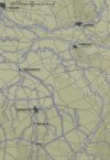
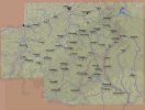
This map is the exact same scale as the bulge maps, and with the contours much more detailed, the old method didn't look good so I tried a different way by having a very subtle dark glow behind each contour layer and a 1 pixel wide blue outline. I'm very happy with the result. The elevations for this map are 20m,50m, & 100m.
I still have to fix the hash lines on the canals, play around with the rail and road effects and decide what fonts to use for the text; I still might keep the old map fonts yet to keep them consistent. I also have to add the prominent towns and labels. Here's a view of what it looks like so far:

The Plodder
Member
*budd*
Member
your a hell of a mapper.
The Plodder
Member
I am my own worst enemy.  After looking at the HTTR map, the Bulge maps now look damn ugly. I just can't leave them that way so I've found a more hi-res map to trace from and I'm now cracking on with that.
I've made up a master map template and once I've finished that, I'll drop in each scenario's map elements (units, boundaries, front line) from the old maps and re-jig them. Hopefully this will only take me a week or so. A lot of those elements were rasters but I'm almost exclusively working in vectors now as they give a more crisp, high quality image and PSP is able to add some effects directly to vector layers as well now. I've also found a way to get the unit symbols on the map as vectors as well so the quality won't be as varied as before when they were rasters.
I've made up a master map template and once I've finished that, I'll drop in each scenario's map elements (units, boundaries, front line) from the old maps and re-jig them. Hopefully this will only take me a week or so. A lot of those elements were rasters but I'm almost exclusively working in vectors now as they give a more crisp, high quality image and PSP is able to add some effects directly to vector layers as well now. I've also found a way to get the unit symbols on the map as vectors as well so the quality won't be as varied as before when they were rasters.
rjantzi
Member
I plan on buying the Commanders Pack in the near future and I'm wondering how many of the modules will come with these Situation Maps (all, some or none)? If all of the maps aren't available yet, what will be the process to add the maps in at a later date when they're finished? Thanks
Dave 'Arjuna' O'Connor
Panther Games Designer
- Joined
- Jul 31, 2014
- Messages
- 3,416
- Points
- 113
- Location
- Canberra, Australia
- Website
- www.panthergames.com
As Rich (aka The Plodder) does them we'll incorporate them in the next build. So they will just get added as per the normal automated update process.
rjantzi
Member
Thanks Dave. Are any of Rich's maps included in the Commanders Pack right now or will they all be added in at a later date?
Dave 'Arjuna' O'Connor
Panther Games Designer
- Joined
- Jul 31, 2014
- Messages
- 3,416
- Points
- 113
- Location
- Canberra, Australia
- Website
- www.panthergames.com
None are in there now. Just the Core scenarios.
rjantzi
Member
Got it. Thanks
The Plodder
Member
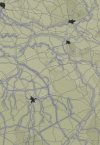
I've been a bit busy with other things the last few days but I've had a pretty productive evening.The contours are done and I'm over halfway through the road network, then it's on to rail.
I got slowed down a bit by the underlying map only going as far as the German border, so I had to use Google Maps and stitch together some screenshots to get a good contour map for the missing area. I then used a site that had digitised a Michelin guide from 1940 to work out the road net for that part.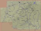
I got slowed down a bit by the underlying map only going as far as the German border, so I had to use Google Maps and stitch together some screenshots to get a good contour map for the missing area. I then used a site that had digitised a Michelin guide from 1940 to work out the road net for that part.

Dave 'Arjuna' O'Connor
Panther Games Designer
- Joined
- Jul 31, 2014
- Messages
- 3,416
- Points
- 113
- Location
- Canberra, Australia
- Website
- www.panthergames.com
Nice work Rich.
The Plodder
Member
I know how much work goes into doing this Richard, and I have searched for a map that showes the rivers, (very important features in WW2), and the road network like you have done here, and couldnt find anything like it, so as far as I am concerned you have a unique map there that is perfect for the SAM's.
Well done mate.
Well done mate.
Dave 'Arjuna' O'Connor
Panther Games Designer
- Joined
- Jul 31, 2014
- Messages
- 3,416
- Points
- 113
- Location
- Canberra, Australia
- Website
- www.panthergames.com
Yeh, bloody marvellous Rich. It's at times like this I really miss the bowing emoticon that we had on the Matrix forums.


Seriously top quality work. I can't see how it could be any better. For me, I think the take home message here is how crisp/sharp/clean/clear the images are as a result of working with vectorised images. It's something I was aware of but had no practical knowledge of. Have since educated myself. Thanks The Plodder!
The Plodder
Member
16 Dec 1944:
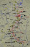
This is the situation without any Fog of War. I'll adjust the map for each indivdual SAM. As you'll notice, I've changed the map's colours and elevation shading, I've switched to dark lower elevations and lighter high ones as I feel the contours stick out better and are easier to read. I've also adapted the colours of the units to match the estabs but I'll make a unit's colour the generic line colour if it breaks FOW.

This is the situation without any Fog of War. I'll adjust the map for each indivdual SAM. As you'll notice, I've changed the map's colours and elevation shading, I've switched to dark lower elevations and lighter high ones as I feel the contours stick out better and are easier to read. I've also adapted the colours of the units to match the estabs but I'll make a unit's colour the generic line colour if it breaks FOW.
Similar threads
- Replies
- 0
- Views
- 1K
