Dave 'Arjuna' O'Connor
Panther Games Designer
- Joined
- Jul 31, 2014
- Messages
- 3,416
- Points
- 113
- Location
- Canberra, Australia
- Website
- www.panthergames.com
Yep they are.
What this will mean when it is fully implemented is that instead of spending hundreds of hours tracing contour lines over a scanned topo map, you will be able to import the elevation data with a few clicks. You will then still need to trace out the terrain - woods, urban, roads etc. But it should save a lot of time creating maps.That's quite an impressive list - good job.
I understand it is work in progress, but can you shed some more light on (and how it will change scenario/map making):
- Geo Implementation for importing GIS elevation data.
That's good news. Just curious, where will one find data to import?What this will mean when it is fully implemented is that instead of spending hundreds of hours tracing contour lines over a scanned topo map, you will be able to import the elevation data with a few clicks. You will then still need to trace out the terrain - woods, urban, roads etc. But it should save a lot of time creating maps.
While the Google Earth Pro available to the general public for free has near real time data on locations based on satellite photography, it doesn't include the appropriate altitude data for building topographical maps.I run Google Earth Pro and have found no tool for exporting GPS or topographical data. Maybe I'm missing something. If possible it would be an awesome tool for creating maps for Combat Mission games as well.
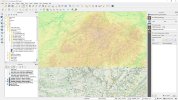
QGIS is a good place to start if you want to learn more about map elevation data.That's good news. Just curious, where will one find data to import?

It's based on REACT, and that wants a basic knowledge of Javascript and HTML, neither of which are familiar to me.Do you want to try Google's Material Design UI?
No. It's based on Java and I'm not a fan.Do you want to try Google's Material Design UI?
It's based on REACT, and that wants a basic knowledge of Javascript and HTML, neither of which are familiar to me.
I'd spend more time learning the script than I would trying to discuss the issues with scenario design.
If you'd want, we could also set up a separate thread on LnL. It wouldn't be as responsive as direct contact, but it might draw an interest from people who have delved deeper into the design problems for a scenario, particularly the mapmaking, than I have.
If you want to collaborate, it would help if you shared whatever historical information you found on the battle -- particularly as it relates to the quality of the forces engaged in combat, the commanders who contested the battle(s), the types of forces that engaged, the tactical goals for the Japanese and Chinese forces, and the strategic situation in China relating to training, equipping, and supplying forces at that timeframe.
I can find some things as well, but they're going to be American-centric. While that timeframe was important in terms of the conflicts of that era, most American history is focused on how the US was recovering from the Great Depression, and addressing the politics of the emerging world war.
This is assuming that the map I sent correctly reflects the area where you want to replicate the combat.
I will use the Java and HTML, this is my job.No. It's based on Java and I'm not a fan.
Not this week. I've been off sick with a cold and we've had a few extra things to do anyway. I'll get back to it next week.So how's that patch coming along?